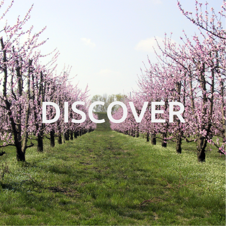
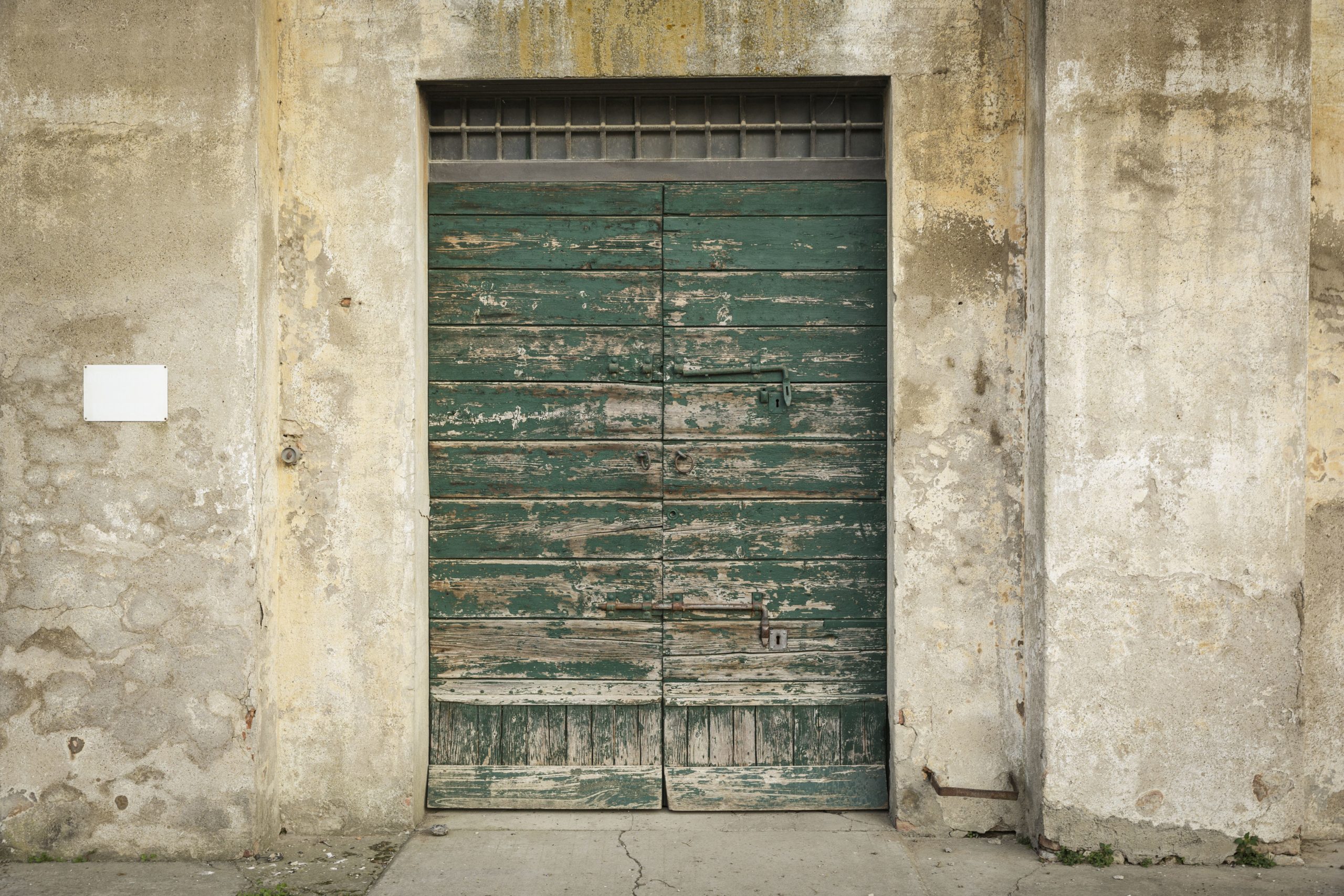
In Bassa Romagna, the landscape, suspended between the earth and the sky, offers visitors such a depth of field that it is impossible to hug it all at once.
Bicycle is certainly the most suitable way to approach, in slow mode, this rich and tidy countryside, pedalling along the river banks, which are perfect viewpoints to discover those historical landmarks that rise over a horizon characterized by numerous waterways. The landscape is studded by parish churches, oratories, manor houses, farm houses, fortresses and noble palaces.
Earth and Water is an itinerary that tells the story of a landscape that has changed over the centuries together and in tune with the changing relation between these two elements.

PRACTICAL INFO
INFO
- Interests: wellbeing, culture
- Duration: 48 h
- Lenght: 60 km
- Target: Cyclotourists, Friends, Couples
- When: All year round
MAP
For the most experts – Download the gpx track
The routes can be downloaded and can be managed with any satellite navigator for outdoor use.
You can use telephone Apps enabled to manage information through geolocation.
The files are all in GPX format, the exchange format , click here
ITINERARY
FIRST STOP
Lugo – Massalombarda (10 km)
The territory of the so-called Bassa Romagna historically corresponds with Estense Romagna, which in the 15th and 16th century belonged to the Duchy of Ferrara, with Lugo as its capital city.
We start from here, from the north-western part of the fertile plain between Santerno and Senio rivers, from the city where the Hero of national aviation Francesco Baracca was born; then we will cross that network of natural and artificial canals and roads, first of all the main road via Emilia. In this land the signs of the Roman centuriation are still alive. This is clearly indicated by the urban topography: it develops along a centurial axis around which the medieval city was built. The cardo connected the inhabited centre to the port and the parish church of San Giovanni in Liba. Its central role was due to its proximity with via Emilia and salt traffic coming from Cervia and Ravenna towards Bologna, as well as its position in the middle between the Po river hydrographic basin and the Trans-Apennine territories. Lugo was also located near floodplain ports and the firm-dry land. This facilitated road transport and the flourishing of local markets, supported by a large agricultural production.
The importance of Lugo and its dignity as a castrum, are referred to on Descriptio Romandiole, the census of Romagna drawn up in 1371 by Cardinal Anglico Grimoard, as well as by the Estense Fortress that dominates its historical centre. When, towards the end of the 14th century, the powerful and rich Lords of Ferrara conquered the heart of Romagna, Romandiola became Romagna degli Estensi (Este’s Romagna), and it remained so until the end of the 16th century. Land reclamation and water control interventions continued also when the Papal Government resumed the power over the area in 1598.
Pedalling from Parco del Loto towards Massa Lombarda, we bike past Villa San Martino; we cross the Santerno river through the narrow cycle/pedestrian bridge “Pungèla” built in the beginning of ‘50s after the German soldiers had bombed the old Pungèla, which dated back to the end of the 19th century.
Along the Santerno river is Sant’Agata, closely linked to its river, an important communication route between Spina and Etruria since pre-Roman times.
SECOND STOP
Massa Lombarda – Conselice (15 km)
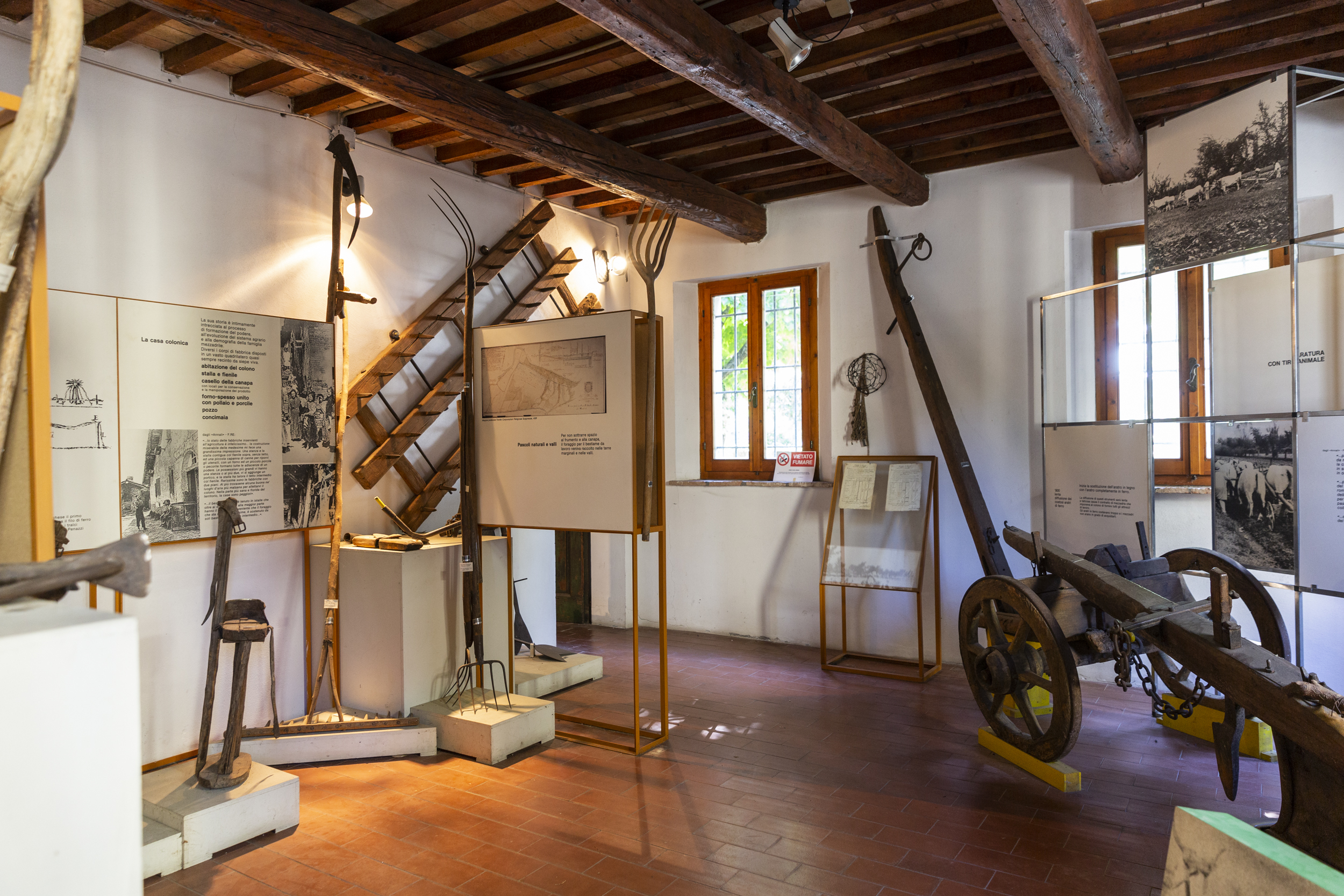
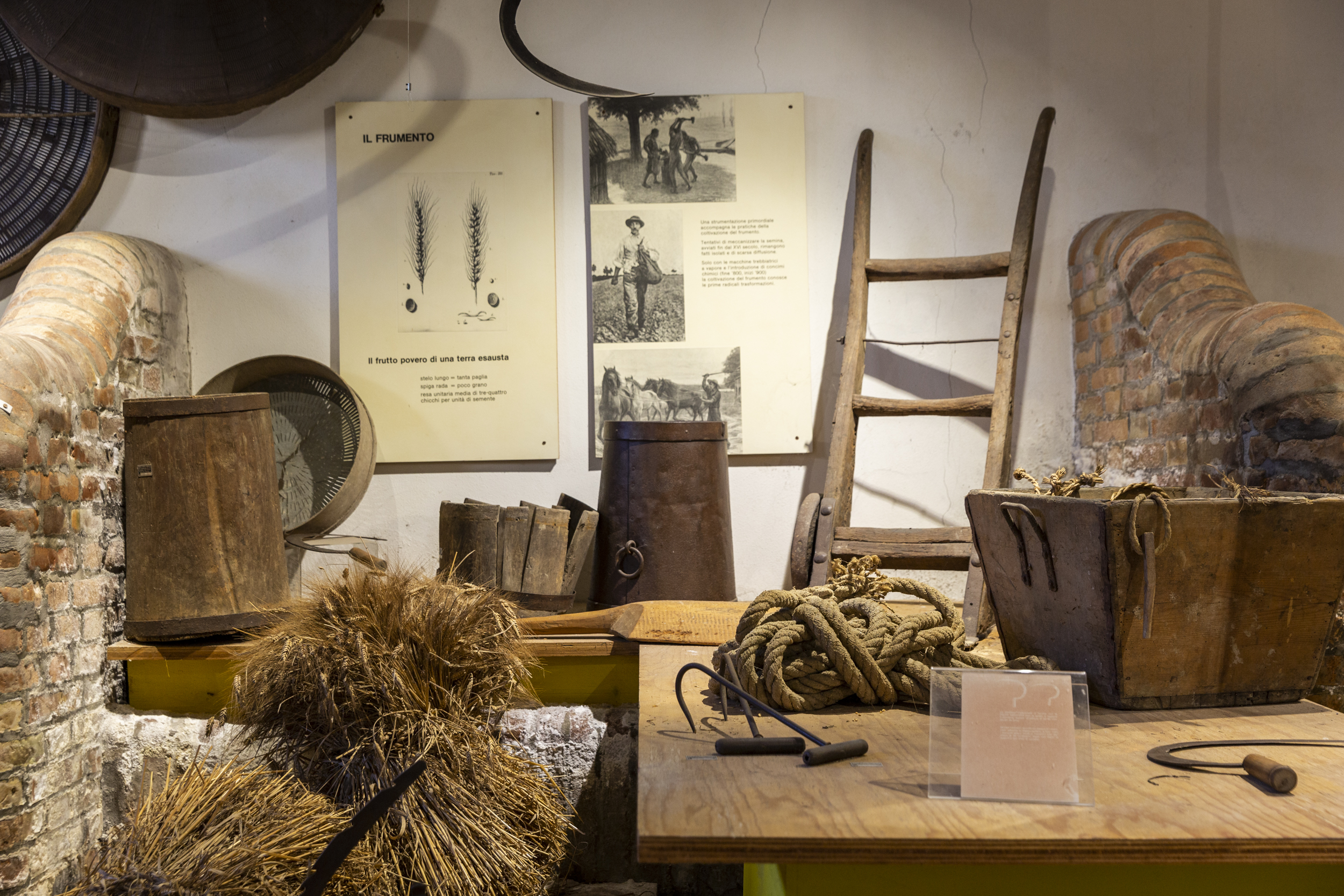
The reclamation of the swampy areas, which took place between the 19th and 20th centuries, was fundamental for the agricultural development of Massa Lombarda, which mainly focused on orchards and the construction of fruit and vegetable warehouses. In fact it is known as the “village of fruits” and in 1927 it hosted the II° National Expo of Fruit farming. In mid ‘70s the Museo della Frutticoltura (Museum of Fruit Farming) was born here.
The name explains its origin: massa Sancti Pauli, an agricultural settlement at the border with Lugo forest, specifically a group of agricultural fields with a church dedicated to St Paul.
It was then called Massa Lombarda in 1251, when many families arrived from the Lombard areas of Brescia and Mantova, fleeing from intimidation by Ezzelino da Romano. The new settlers received the land, subdivided into regular squares, in exchange for their commitment to reclaiming and farming it.
With regard to watercourses, along via Imola it is possible to admire the fascinating old wash house (today it stages theatre performances, narrations, music and dance), fed by the water of Canale dei molini di Imola e Massa. The Canal, stretching for around 40 km, starts from the Santerno river and, after going around Imola, it touches upon Bubano, San Patrizio, Conselice, Lavezzola, it runs along via Selice, until it flows into the Reno river near the so-called “della Bastia” bridge. It is probably a Roman construction, regenerated in the 6th century by the Benedictine monks of Santa Maria in Regola monastery in order to reclaim the lowlands, but before feeding the many mills it is named after, it was used as a very efficient waterway for transporting goods on small boats.
We leave Massa Lombarda cycling past the Santuario della Consolazione and the interesting monumental cemetery. We drink a sip of water near Pieve di Santa Maria in Centumlicinio or Fabriago with its extremely ancient cylindrical church tower.
Before arriving in Conselice we cross San Patrizio, a hamlet of Conselice located along via Selice: it is a parish church, documented since 1092, around which the village of San Giovanni in Pentecaso was set up, until mid 13th century. Due to its favourable position between the forest and the lowlands, it often caused fights between Conselice and Massa Lombarda.
The hamlet boasts the presence of a mill, built towards the end of the 15th century, above Canale dei Molini di Imola e Massa Lombarda. It consists of the original plant – which was owned by Duke Francesco Pico della Mirandola – on a rectangular layout lying over the canal with two arcades. Even if it still keeps the old equipment, the mill had to undergo substantial restructuring and extension work in the ‘50s.
THIRD STOP
Conselice – Ca’ Massari (3 km)
The territory of Conselice, located at the centre of a thick hydrographic network, is characterized by a thousand-year-old relation with the river water and the wide floodplain areas. Located between the Sillaro river in the west, the Reno in the north and the Santerno in the East, it is crossed by Canale Zaniolo, a wide collector that comes from Mordano. The territory is characterized by the presence of the already-mentioned Canale dei Molini di Imola e Massa Lombarda. Thanks to this Canal, in the ancient times Conselice acted as the port of Imola. The Canal ran along via Selice all across the floodplains and then reached Po di Pimaro. This is thought to be the origin of the name Conselice: Portum Capitis Silicis, as mentioned on a document from 1084, although the first forms of settlements are much older. In the 2nd century B.C., at the time of the Republic of Rome, the territory was subjected to reclamation work and water regulation through the centuriation system, the subdivision of the land into regular squares to be allocated to the settlers and which is still visible today (via Emilia was the decumanus maximus; via Selice was cardo maximus).
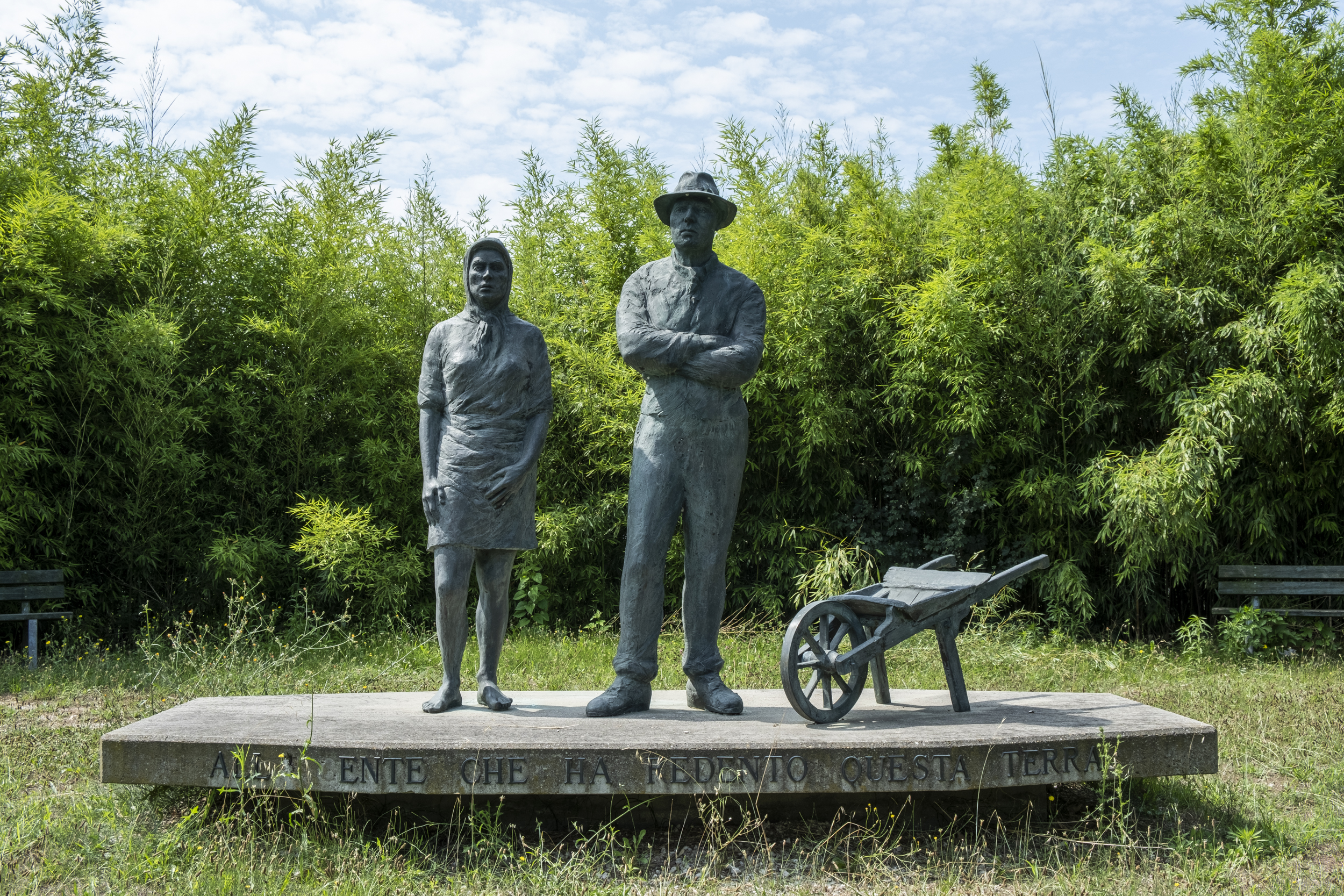
In 1435 there was documented presence of meadows, woods, forests, marshes, backwaters, floodplains and piscarie, namely areas where it was possible to graze, hunt and fish. Between the 18th century and the 19th century unfarmed spaces were gradually replaced by rice fields and small farmed fields. In particular in those years the swampy and non-productive lands started being exploited for rice production – a good way to fill the low-level land and use it for cereal production. Right in the rice field water the breeding of frogs become popular. This granted the village the name “the land of frogs”; the monument to the frog located at the centre of the village entrance roundabout testifies it. It is not the only sculpture to remind the story of the village: in the public park the sculpture dedicated to rice field workers and “scariolanti”, made in 1990, pays tribute to the one-hundred-year anniversary of mondine’s fight, which ended up in a terrible massacre. After that tragic event, between the end of the 19th century and the beginning of the new century a cooperative was set up joining the labourers of Conselice, Lavezzola and San Patrizio, which over time progressively paved the way to deep economic and social redemption of those populations. That past can be found on the faces depicted on the piazzetta Guareschi murals: artworks inspired to the “small world” of Guareschi and the floodplain landscape.
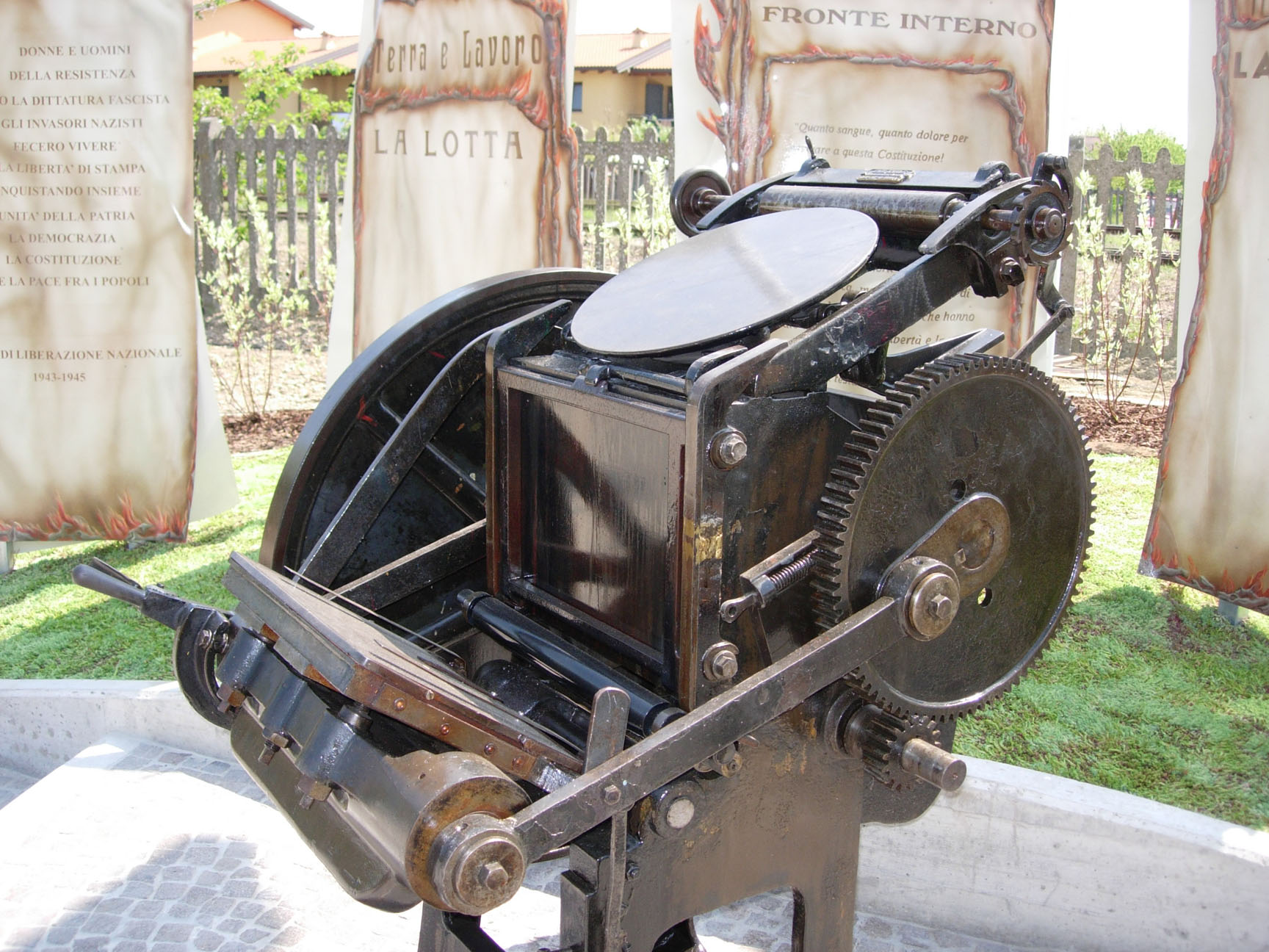
In Piazza della Libertà di Stampa an old pedal-typing machine is displayed as a Monument to Underground Press and Press Freedom, to remind the strong commitment of the Comitato di Liberazione della Bassa Romagna (Bassa Romagna Liberation Committee). A few km from the centre, towards the border with Ferrara, we get at Cà Massari, strategically positioned as a restaurant and accommodation.
Its modern history started in 1919, when the labourers’ cooperative called Federazione delle Cooperative di Ravenna bought the Massari estate, owned by Massari Zavaglia family from Ferrara until that moment. The previous owners had exploited those low and wet lands for rice farming, but the new owners reclaimed those swampy areas for the production of new dry crops.


FIFTH STOP
Ca’ Massari –Lavezzola (9 km)
The Cooperativa Agricola Braccianti (CAB) Massari , born out of the merger with other CABs (Cooperativa Agricola Braccianti) in 1997, has its origins in the beginning of the last century: in particular its story is strongly interlinked with Conselice and contributed to its development, always in compliance with the principles which are typical of a cooperative movement. A strong reality, that managed to resist the hardships of the twenty years of Fascism, was able to recover from war destruction and guaranteed employment to a poor land, whose only resource were the workers’ arms, the “braccianti”. Today it can be defined as a vast holiday-farm, which has been able to join its agricultural activities with tourism and catering, by keeping its past legacy alive, like the rice warehouses and tobacco factory. They managed to regenerate the floodplain area, which is now enjoyed by people during their free time but also an ideal shelter for sedentary and migratory birds. They have recreated that unique landscape where earth and water have been coexisting for centuries.
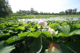
We continue along Canale Zaniolo that, together with the parallel-running Cavo Gambellara enters the Canale di Bonifica destra di Reno near “Botte Selice” and then continues until the Reno river. Towards the centre of Lavezzola it is impossible to miss Vallesanta and the protected oasis of Campotto behind the watercourse. These environments engage us emotionally thanks to their undisputable fascination, which is even deeper with autumn mist or with the sunset bright colours.
QUINTA TAPPA
Lavezzola – Santa Maria in Fabriago (12 km circa)
The village of Lavezzola (now a hamlet of Conselice) was born in the 15th century as a feud given by the Estes to Giacomo of the noble Lavezzoli family. The territory in concession, located between Po di Primaro and Frascata, allowed to grant the security of the northern borders of Romandiola. The little village lived in symbiosis with the Primaro river in the north and with the floodplain landscape. From the right-hand side of the river bank, the landscape used to bend to the South, where the Senio and the Santerno rivers joined together. Seasonally, the land emerged and filled the backwaters with debris.
The “extremely muddy” Santerno river, with its bends, was extremely precious for land reclamation.
Canale Zaniolo, instead, wide and with a large capacity, was used for navigation and milling: in 1565 it used to feed up to twenty mills. Its name seems to be linked to its owner, miller Martino, mentioned by a notary deed in the 14th century that refers to fossatum Martini Zanioli. In the 14th century its navigability is confirmed by the presence of a chain, a “checkpoint” at Bastia for tax collection and to fight against illegal traffic. For centuries Primaro river was fundamental: it was a sort of road artery with its watercourses and dry and viable banks, at a higher level than the surrounding marshes.
Due to the land morphology, it was always necessary to control the water and the many annual floods that inundated the crops and hindered the milling activities. These problems were solved with the Reno river being permanently channelled into Po di Primaro, after excavations and bank rising with autonomous mouth at the end of the 18th century.
In the heart of the inhabited centre it is worth having a look at Villa Verlicchi, before continuing towards La Frascata – this name refers to the right of “frasca” enjoyed by the first inhabitants, who were devoted to fishing and hunting before the water and the forest were turned into arable land. Make a diversion on the bank before arriving at La Frascata. Cross the bridge on the Santerno river, after walking past the Oratory of Passogatto (18th century). Before arriving in Santa Maria in Fabriago, go through San Bernardino, a little residential and agricultural location in the Lugo countryside positioned on the right bank of the Santerno river. Along the river bends you will find a little road called “carrara della fortuna” (road of fortune): here at the end of the 19th century a hot-air balloon flying from Bologna “deflated”, but the passenger landed safe and sound. A memorial stone is still positioned where the balloon touched the ground. At the exit of the village you can admire Villa Tamba (17th century, located in Bellaria). You finally arrive at Santa Maria in Fabriago.

FIRST diversion
From the banks of the Santerno (round trip 21 km)
Starting from the banks of the Santerno river, you enter the countryside suspended between water, earth and sky: a path between oratories, sanctuaries, ancient villas and bridges over the rivers, from Passogatto to Voltana to San Bernardino.
SIXTH STOP
Santa Maria in Fabriago – Lugo (11 km)
The ancient village is located on the left-hand side of the Santerno river. Just like the near village of Campanile, it was part of the parish Church of Santa Maria in Centumlicinio, that only in 1091 took the name Santa Maria in Fabriago.
The proximity of the small floodplain harbour of Petrodolo, which put into communication the territory with the Primaro river, was a vital trade centre and is still reminded of by via Predola, which runs across Fabriago countryside and whose name is connected to the ancient harbour of Petrodolo or Predolo. In the 8th century the territory of Fabriago, surrounded by water, was a fundus mainly inhabited by families devoted to fishing and hunting. Around the middle of the 13th century, after floods that made the territory unhealthy, the community of Fabriago accepted to be acquired by Lugo, which enlarged its borders. The toponym Santa Maria in Fabriago is quite recent and refers to a territory that was once called Bruciata or Brusata, named after the land of a certain man called Brusatus de Fabriaco (1188). After the channelling of the Santerno river in 1460, as a reference to the river that used to cross it, the territory took the name of “Brusata di qua” and “Brusata di là”. Near the left bank, at a higher level than the surrounding land, a fortified bastion was built, with the inhabited village all around it. In the 17th century the first core of the Castle of Fabriago was built. It was then subjected to many changes and renovations.
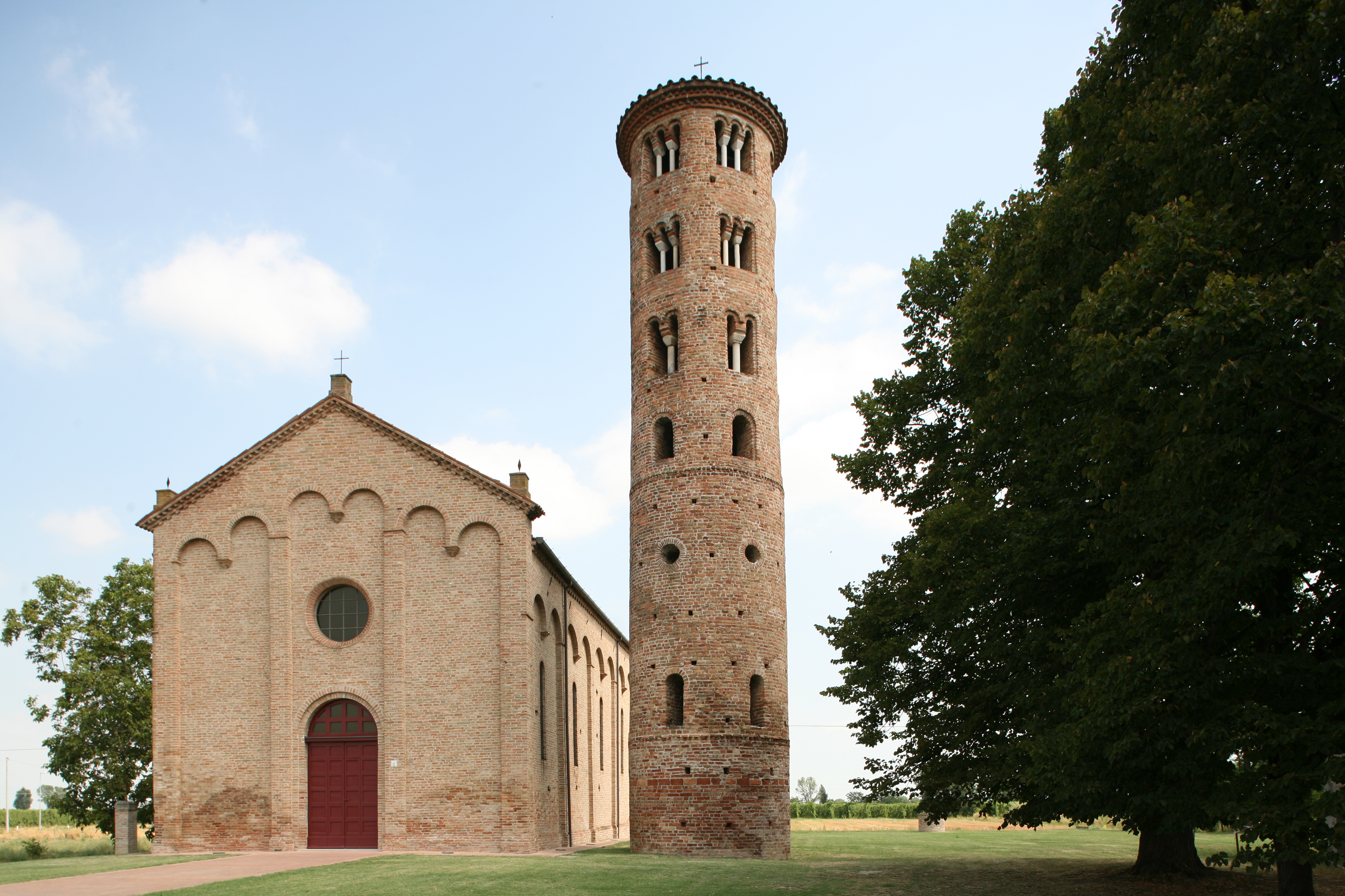
The story of Fabriago is very emblematic of the relation between the earth and the water, hostile to human settlements, but essential for the survival of the economy and functional to traffic and commercial trade. After the year 1,000, Fabriago became a flourishing castrum, but already towards the end of the 12th century it suffered from a new hydrogeological crisis that caused a comeback of unfarmed lands and marshes. As a consequence, the inhabitants moved out, leaving a desolated, frequently flooded territory, with an un-kept and ruined church that is represented today only by the bell tower, which gives its name to the inhabited centre.
Along our journey we arrive in San Lorenzo: the first reference to this hamlet in the municipality of Lugo, located along the Santerno river banks, dates back to the 15th century. At that time, with the new river route and the parallel road running towards Ferrara, new settlements were built. Among them was the village and parish of San Lorenzo in Selva and, more in the north on a river ridge was San Bernardino in Selva.
Via Fiumazzo, previously called via del Fiunazzo, old riverbed of the Santerno river, starts in San Lorenzo and runs across Torre and Belricetto until Passogatto. Its etymology explains the transformations related to the river and the human interventions.
To learn more about “The territorial configuration, the river network and the water basins of Bassa Romagna”,click here
Discover other places along river banks and canals in Bassa Romagna! Click here
Fountain Map realised by Ciclo Guide Lugo